Source document: Calculus Volume 3 (PDF, 272 pages)
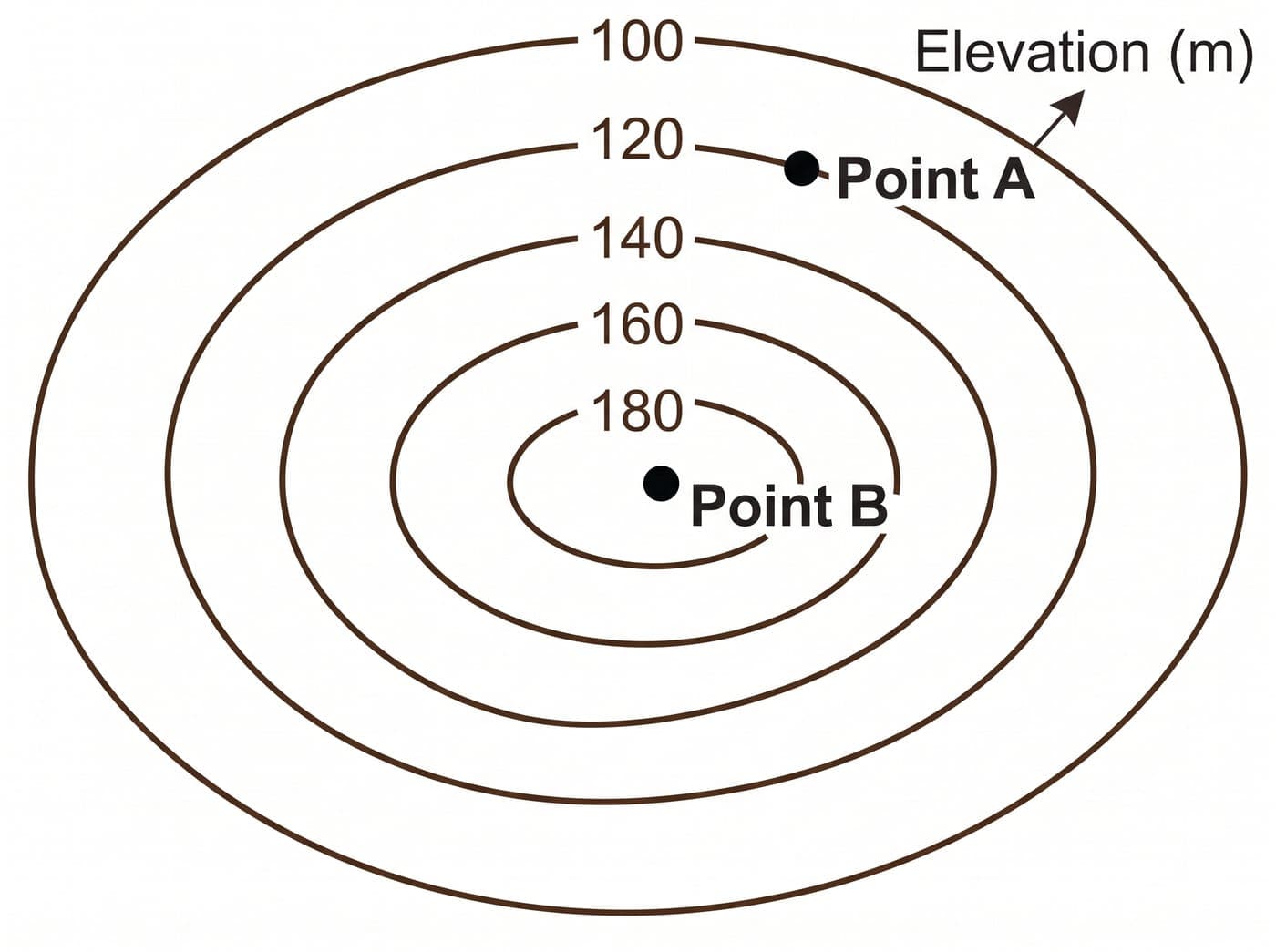
A civil engineer is analyzing the topographical map of a mountain to build a road. The contour curves represent constant elevation in meters. According to the map, what is the elevation difference between Point A and Point B?
- A)60 m
- B)80 m
- C)20 m
- D)40 m
Show the answer key and explanation
Correct answer: A — 60 m
Explanation: By reading the contour map, Point A is located on the level curve labeled 120 m, and Point B is located on the level curve labeled 180 m. The elevation difference is calculated by subtracting the lower elevation from the higher elevation: 180 m - 120 m = 60 m.
What this example shows: A textbook chapter becomes a scenario: the contour map is constructed so that the two marked points sit on named elevation lines. The question cannot be answered from the stem alone.